

Role: Wayfinding Strategy, Information Design, Environmental Graphics, Map Design
Five conferences. Five venues. Five different approaches to helping people find their way.
Each year, Healthy Teen Network's national conference takes place in a new setting, bringing different architectural layouts, navigation challenges, and opportunities for design.
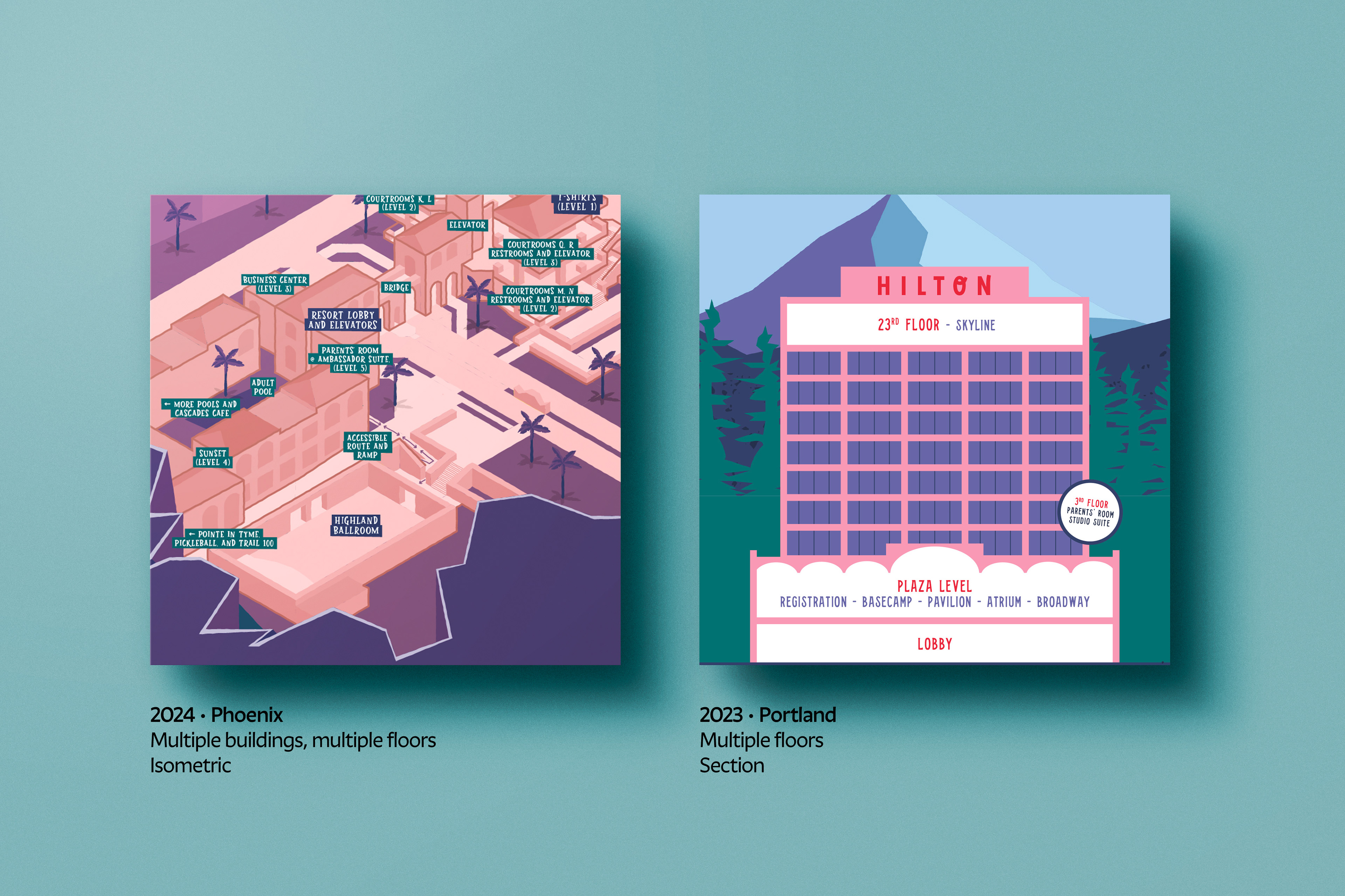
From single-level sites to multi-building, multi-floor venues, I developed wayfinding systems that made unfamiliar spaces easier to navigate. My work included interpreting architectural plans, designing attendee maps, determining signage placement, and creating directional signs that complemented each conference's visual identity.
No two venues presented the same navigation challenge. Each required a different way of representing space, from site plans to sections to isometrics.

Three arrival points. One coordinated navigation system.
For the 2026 conference, I mapped three attendee journeys—hotel guests, valet and rideshare arrivals, and self-parkers—to understand how people would approach and move through the venue to register and attend their first session.
By tracing each route, I identified key decision points and determined where directional signage would be most useful, creating a coordinated wayfinding experience for attendees arriving from different locations.


Connecting physical and digital navigation
For the 2026 conference, attendees could explore an interactive site map in the conference app, zooming in and out to view details and navigate between buildings and conference spaces. Directional signs complemented the map, creating a coordinated wayfinding experience.
Wayfinding beyond the map
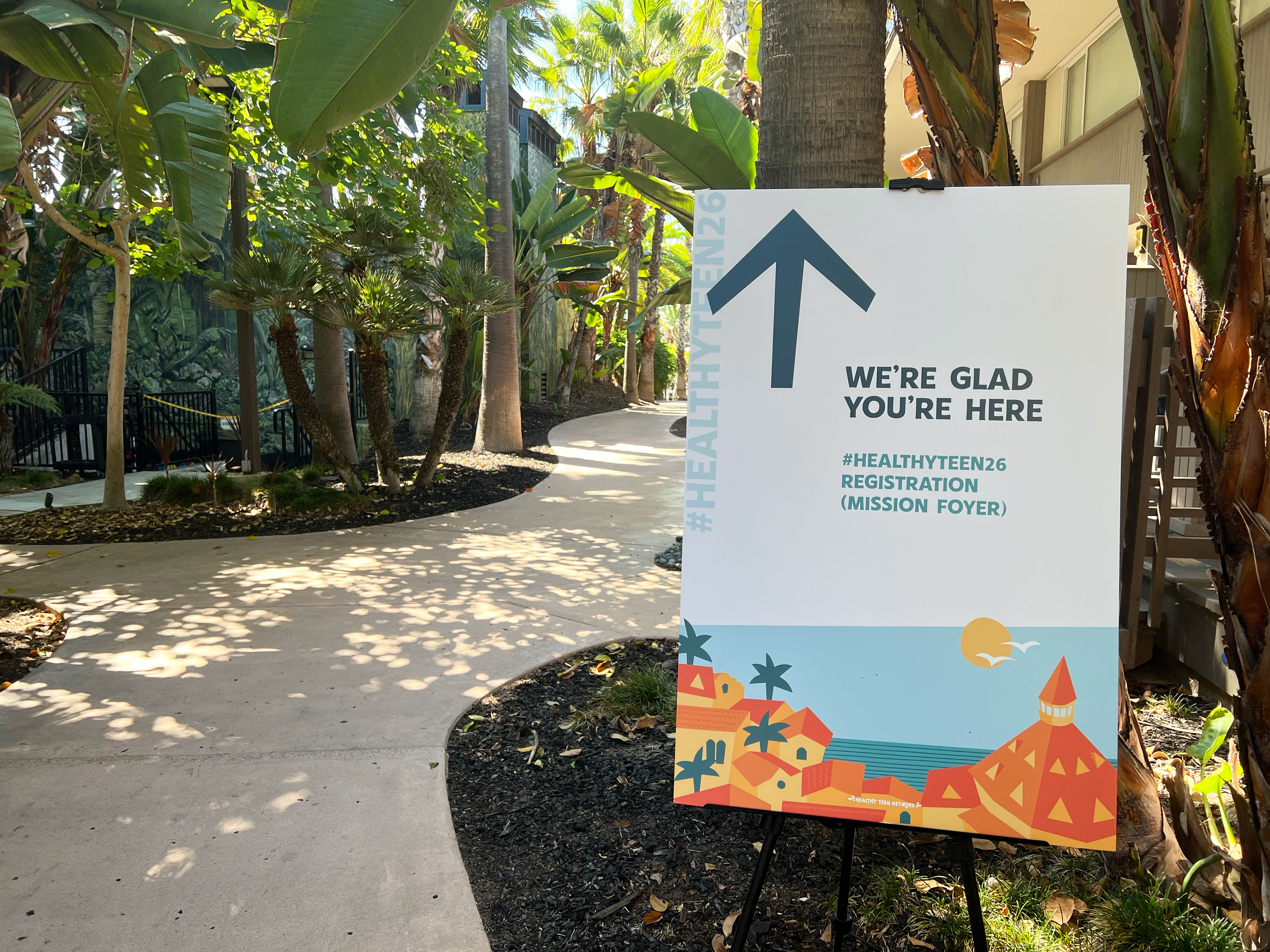
More than 20 directional signs helped attendees navigate the conference venue, extending the maps into the physical environment. Consistent destination names and visual cues connected each sign to the larger wayfinding system.
The signs also carried the conference's visual identity. The sign pictured above features an original illustration I created, inspired by San Diego's architecture and coastal landscape.
Five years of finding our way
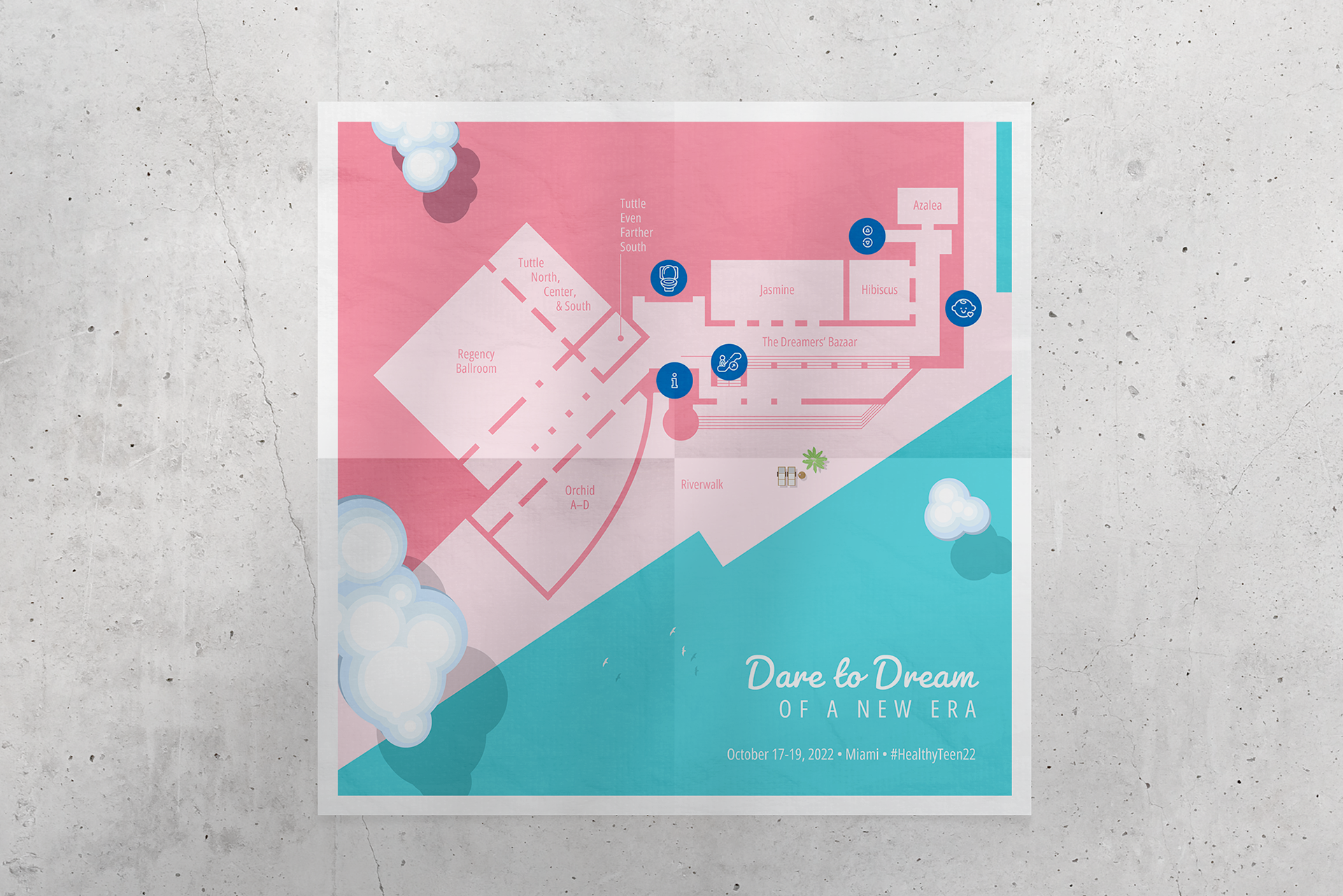
Each conference brought a different venue, visual identity, and navigation challenge. From illustrated site plans to architectural sections and axonometric maps, the wayfinding systems adapted to the spaces they served.
In 2022, the site map was also printed on attendee badges, keeping navigation close at hand in a compact, accessible format throughout the conference.
